The Only Place in the U.S. Where You Can Stand in Four States at Once (And Why the Marker Might Be Wrong)
The United States has only one place where four state borders meet at a single point. It’s marked by a circular monument in the desert, and every year, visitors line up to stand with a hand or foot in each state at once. It feels like a perfectly exact point brought off the map and into real life. But the spot where people line up for photos isn’t exactly where those borders were supposed to meet first.
Where Four States Meet
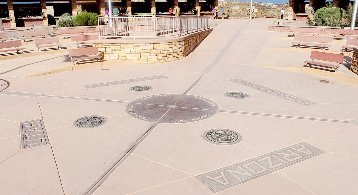
Image via Wikimedia Commons/MARELBU
The Four Corners Monument marks the intersection of Arizona, Utah, Colorado, and New Mexico. It’s in a remote stretch of high desert within the Navajo Nation, surrounded by open land and small vendor stands selling handmade goods.
Visitors step onto a bronze disk set into the ground, placing hands and feet across the quadrants to claim all four states at once. The layout is direct and easy to understand, which is part of why the site draws so much attention. It turns a map into something physical without much explanation.
The monument itself has been updated several times, but the idea behind it dates back to the late 1800s, when surveyors first worked to define the exact meeting point of these territories.
The Line That Was Supposed to Exist
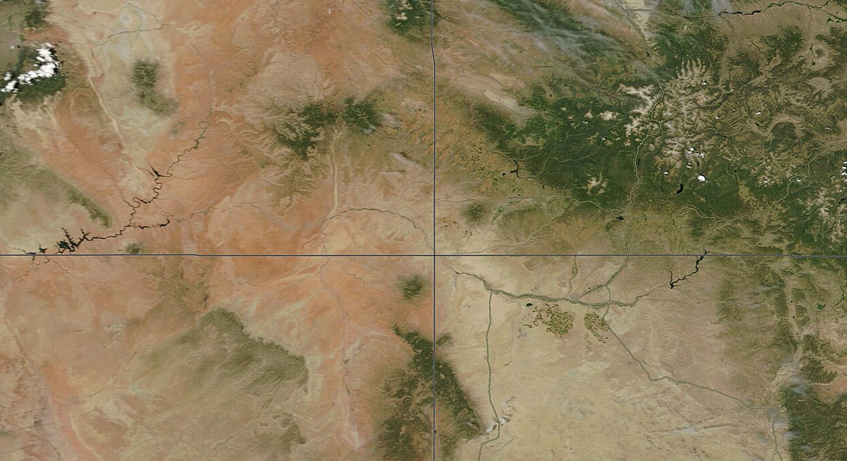
Image via Wikimedia Commons/MODIS Land Rapid Response Team, NASA GSFC
The borders here were not shaped by rivers or mountains. Instead, they were defined by straight lines based on latitude and longitude, specifically 37 degrees north and 109 degrees west. On paper, that creates a clean, exact intersection. On the ground, it proved far more difficult to achieve.
When surveyors first marked the boundary in 1868, they worked with limited tools and navigated challenging terrain. A steep plateau made the process difficult, and despite efforts to follow the intended coordinates, the final marker ended up slightly offset from the theoretical intersection.
That surveyed point, once recorded and accepted, became the foundation for the boundary itself. With modern GPS and surveying tools, that gap is now clear. The monument sits about 1,800 feet away from the point where the borders were originally meant to meet.
The intended point lies slightly to the east of the current site, away from the paved platform and main visitor area.
Why the Marker Stayed Put
If the location is not perfectly aligned with the original coordinates, the next question is why it hasn’t been moved. The answer comes down to how boundaries are defined.
In 1925, a U.S. Supreme Court decision reinforced the principle that state boundaries follow the lines established by the original surveys, even if those surveys contain inaccuracies. Once a boundary is marked and accepted, it carries legal authority.
That means the current position of the Four Corners is not considered an error under the law. It is the official boundary. While modern measurements can highlight discrepancies, changing a state boundary would require agreement among multiple states, federal approval, and coordination with tribal authorities. That level of revision is rare, especially for a long-established border.
A Landmark Built on Imperfection
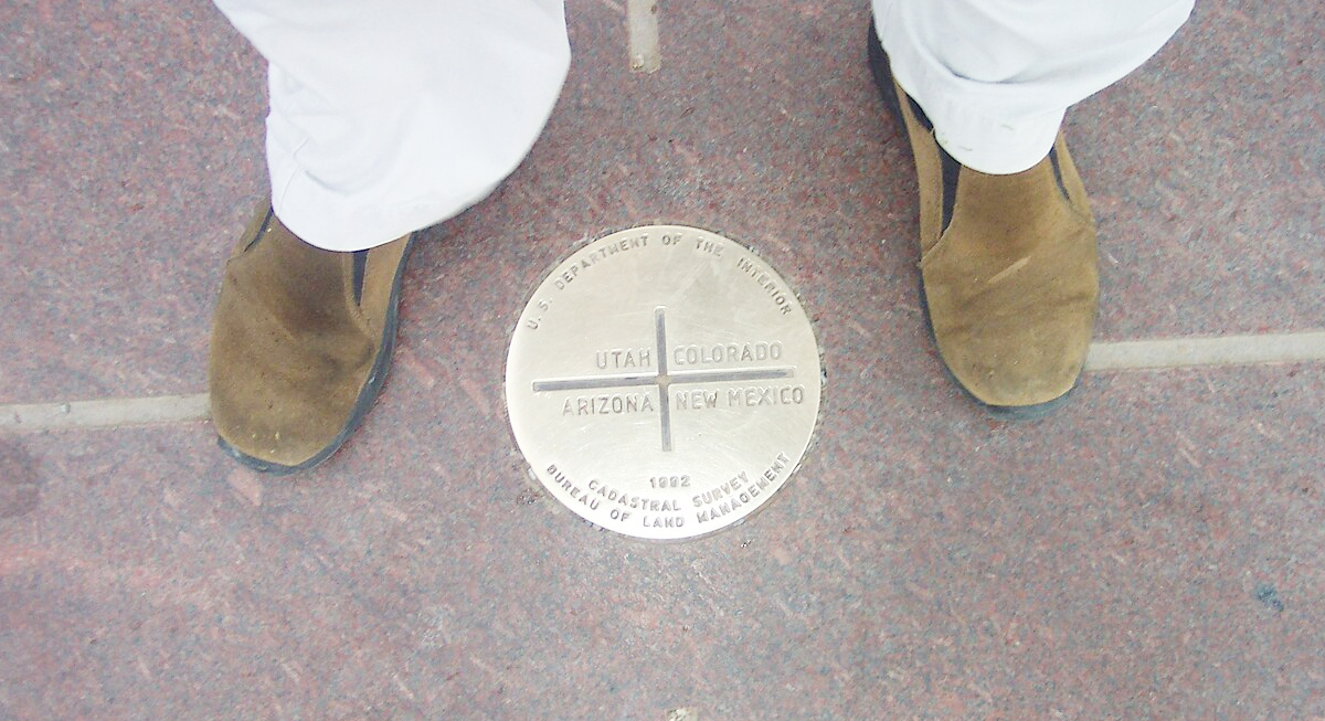
Image via Wikimedia Commons/Cqui
So, are you really in four states? Yes, according to the law. No, according to geography. The distinction rarely affects the experience for visitors, though, as the moment still carries the same appeal.