Scientists Just Revealed What Is Hiding Under Antarctica’s Ice and It Is Wild
Nearly 90 percent of Antarctica is buried under ice that averages about 1.3 miles or 2.2 kilometers thick. In some areas, the ice stacks up to nearly 3 miles or 4.8 kilometers deep. For years, scientists relied on radar surveys spaced far apart, which left huge gaps in what they could see.
New mapping work combines satellite observations of the ice surface with physics-based models of how glaciers move, revealing thousands of hills, ridges, valleys, and mountain ranges that were either poorly mapped or completely unknown. In some regions, the land below sea level stretches across wide basins, while sharp peaks rise nearby, hidden the entire time.
Rivers And Lakes Flow Where Gravity Should Not Allow Them
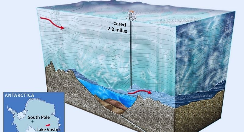
Image via Wikimedia Commons/Nicolle Rager-Fuller NSF
Beneath that uneven ground is a vast plumbing system. Scientists have identified more than 400 subglacial lakes, including Lake Vostok, which is located under about 2.5 miles or 4 kilometers of ice. These lakes connect through narrow rivers fed by meltwater created at the base of the ice sheet.
The strange part is how that water travels. Pressure from thick ice can overpower gravity and send water uphill for hundreds of feet. Researchers mapped these flow paths by combining ice thickness data with bedrock topography, thus revealing rivers that bend, split, and reconnect in ways that seem backward by surface rules.
Sediment Zones Speed Up Ice Loss
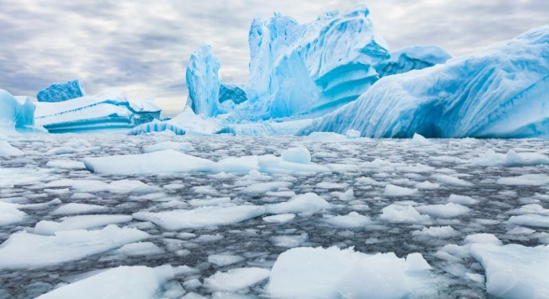
Image via Getty Images/anyaberkut
Not every hidden feature looks dramatic on a map. Some of the most important areas are broad plains of soggy sediment beneath the ice. In these zones, glaciers behave like massive sheets gliding over mud.
West Antarctica contains large stretches of land below sea level, currently held back by the sheer weight of ice above. As thinning continues, seawater can move inland, lifting ice and increasing instability. Scientists describe this setup like ice resting inside a bowl. Once it pulls back from the rim, retreat becomes harder to stop.
Subglacial Rivers Supercharge Coastal Melting
Where subglacial rivers exit into the ocean, the impact multiplies. Fresh water surging from beneath the ice stirs warmer seawater upward, pressing it against the underside of floating ice shelves. Satellite measurements show melt hot spots in these exact locations, sometimes thinning ice by 100 to 300 feet per year.
Modeling focused on the Totten Glacier in East Antarctica shows how serious this can get. Totten alone holds enough ice to raise global sea levels by about 12 feet. Projections that include subglacial river flow suggest ice loss there could increase by roughly 30 percent compared to older models. By 2100, water discharge beneath Totten may grow nearly fivefold, reaching about 5,700 cubic feet per second.
Some Of This Landscape Predates The Ice
Parts of Antarctica’s buried terrain are very ancient. Researchers identified river-carved valleys and hills covering about 12,000 square miles or 32,000 square kilometers that likely formed before Antarctica froze around 34 million years ago. These areas were sealed off through multiple warm periods.
The land’s shape controls how ice moves above it. As climate conditions push the system closer to thresholds last seen millions of years ago, that ancient terrain starts influencing modern outcomes.