
Three map-reading moves that make old trade roads and new city blocks snap into focus, from dockside alleys to freight spurs.
Dock names that survived the docks
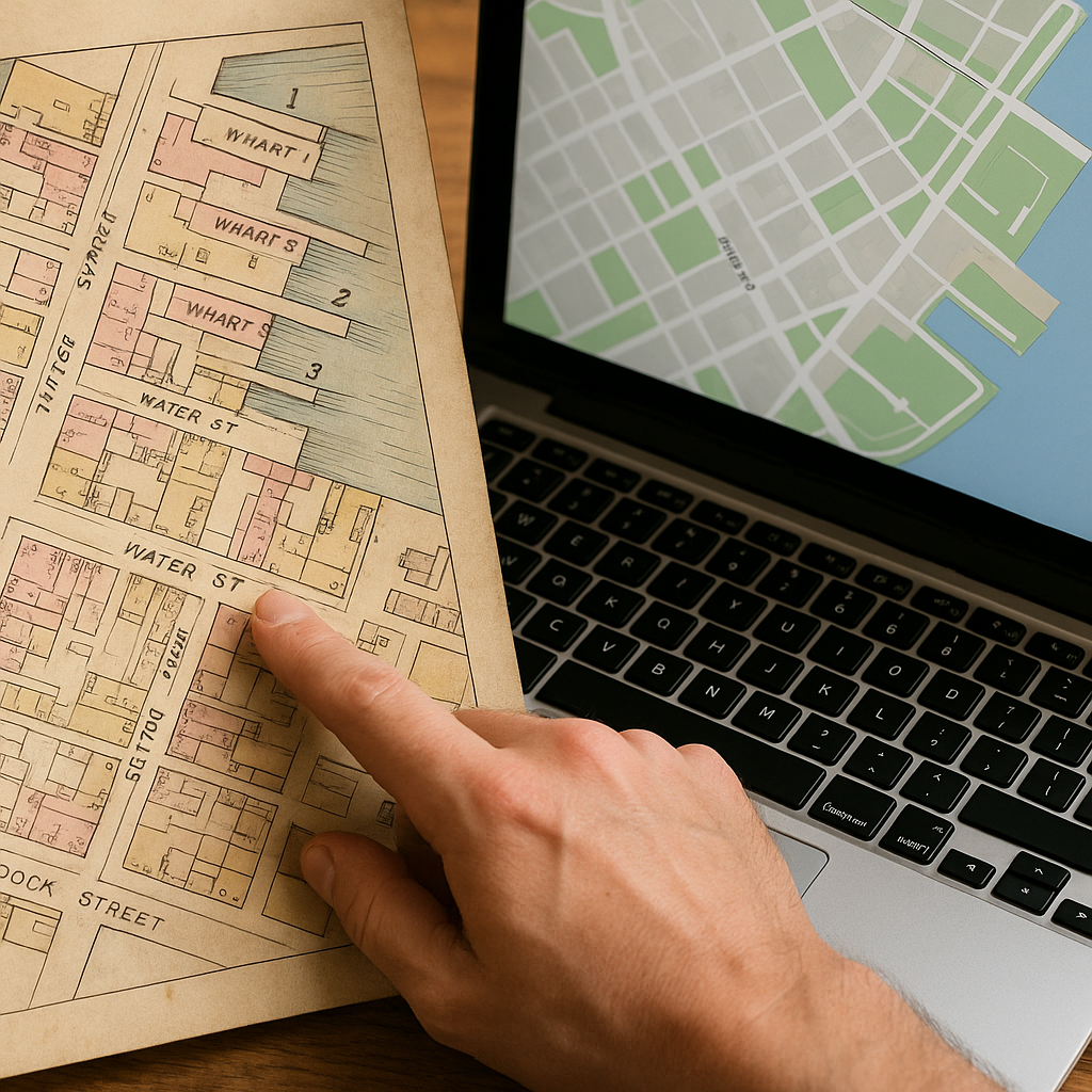
If you want to trace an old trade route through a modern city, street and waterfront names are a useful place to start. I like Sanborn fire insurance sheets for this because they were drawn for underwriters, not romantics. Sanborn maps can show wharves, street widths, property boundaries, building uses, construction materials, and other details that help reconstruct how commercial districts functioned.
Here's the move. Pull a Sanborn plate for the oldest water access in town (river landing, creek mouth, old harbor edge) and then open a modern basemap next to it. Don't align by the shoreline. Align by the stubborn stuff: a church footprint, a courthouse square, a railroad right-of-way that never budged, or a diagonal street that still refuses to behave. Once you've got those anchors, scan the old sheet for words like "Market," "Exchange," Custom House, Sugar, Tobacco, Fish, Lumber, or just Wharf. Those labels can provide clues about former commercial activity, although explaining a street width, an alley, or a property pattern usually requires corroborating evidence from maps or historical records.
The part that always hits me is the afterlife of a dock name. A pier is gone, the bulkhead got rebuilt twice, and the waterline walked away, but Water St or Dock Alley stays glued to the grid. Following the name inland may help preserve commercial features such as former market areas, warehouse districts, or streets associated with historic waterfront activity. Taken together, those clues can help trace a possible route between the waterfront and the commercial district.
The diagonal that isn't a mistake

A diagonal street cutting through a later grid can sometimes preserve an older road, property boundary, topographic route, or other preexisting feature. In some colonial port and river towns, an older road may have connected a landing, ferry, market, or inland settlement before a later street grid was imposed. When the town later straightened itself out, it didn't erase the path. It was built around it.
To read that diagonal with some discipline, I do a quick three-layer check. First, turn on hillshade or a terrain layer. A diagonal that follows a ridge, avoids low ground, or takes an easier grade may reflect older transportation choices, but historical maps are needed to confirm that interpretation. Second, look for where it collides with later streets. Triangular lots and offset intersections can indicate that different street plans or property patterns were laid out at different times. Third, follow the diagonal to see what it connects. Does it aim at a former courthouse square, a common, a market house, a mill seat, or a bridgehead? If the diagonal connects documented historic destinations, that can strengthen the case that it once served as an important route.
When I'm walking it, I watch for merchant-city clues that match the map's logic. Building age, lot width, loading doors, and side alleys can provide additional clues, but these features require historical records or maps to be tied to an earlier trade route. Occupational street names such as Cooper, Tanner, or Baker can be historical clues, but the name should be checked against local records before linking it to a specific trade district.
Nothing about this requires a perfect historical overlay or a fancy GIS workflow. It's more like learning a city's handwriting. Once you train your eye on that one diagonal, you start noticing its cousins: a kink near a former creek crossing, a bend that avoids low ground, a straight shot that ignores later property lines. A surviving diagonal can preserve evidence of an earlier transportation route beneath a later street plan.
Reading a freight spur like a timeline
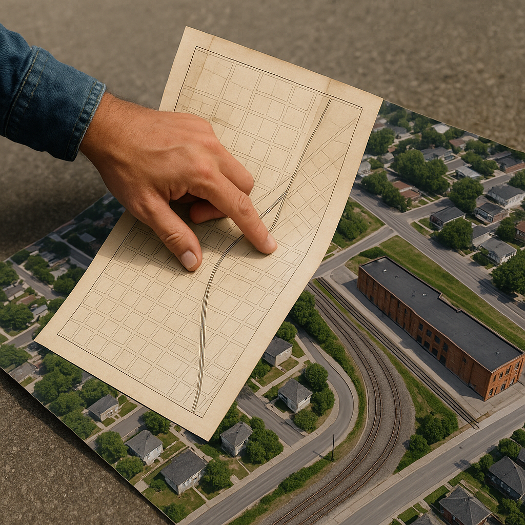
Later rail networks sometimes reused or connected with older commercial districts, waterfronts, and transportation corridors. One of my favorite tells is the modest freight spur: that little branch line that peels away from the main rail corridor to poke into a warehouse zone, a mill yard, or a waterfront edge. On old USGS topo sheets and city plats, it looks like a minor detail. On the ground, it often explains why a neighborhood's streets were laid out as they were and why certain blocks became commercial hubs while others remained residential.
Start by finding the spur's geometry on a historic topo map, then compare it with the current aerial imagery. You're looking for continuity and scars. Continuity looks like a straight, unusually wide right-of-way that turns into a multi-use trail, a service road, or an oddly placed line of back fences. Scars look like a string of long lots that all share the same rear boundary, a warehouse row that faces away from the main street, or a set of buildings that have blank walls where you'd expect windows. Those patterns may reflect former rail access or industrial land use.
Now tie it back to the colonial-era movement. A historic freight spur may connect to a waterfront, warehouse district, factory, mill, or another freight-generating site. Still, its purpose should be checked against period maps and local records (grain mills, lumber yards, ship chandlers). If period maps show that the rail spur served an older commercial node, they may reveal how freight movement shifted from roads or waterways to rail while parts of the established business district remained in use.
If you're walking this with a map app open, zoom in enough to notice the small stuff: street names that reference commodities, a Warehouse Row that isn't on any tourist map, or a sudden density of brick buildings that matches the fire-risk logic of insurance mapping. And pay attention to where the spur ends. Dead ends are informative. A spur terminating behind a block may indicate a former loading area or industrial yard, but historic maps, property records, or photographs are needed to establish the site's earlier use.
I like this approach because it makes urban development feel less like a lecture and more like a series of practical decisions. Historic maps can show how rail access, industrial land use, streets, and waterfront activity changed across successive periods of a city's development.