Chile’s Aysén Region Is the Untamed Patagonia Alternative for Intrepid Travelers
Patagonia usually brings one place to mind first, and that’s Torres del Paine. It’s accessible, mapped out, and built around well-known routes that run on a schedule. Aysén is located further north on the Chilean side and operates under different conditions.
Fewer people reach it, and large sections still rely on long drives, boat access, or self-guided travel. That difference comes down to how the region developed. A road connecting Aysén to the rest of Chile only began construction in 1980, and the southern end of that route wasn’t fully connected until 2000.
Even now, the main highway through the region stops where the terrain makes further construction impossible. That timeline shaped what exists today. Many areas remain difficult to reach, services are spread out, and travel is time- and effort-intensive.
Aysén delivers the same scale of landscape people expect from Patagonia, but without the systems that make those places predictable.
Isolation Isn’t a Marketing Angle, It’s a Reality
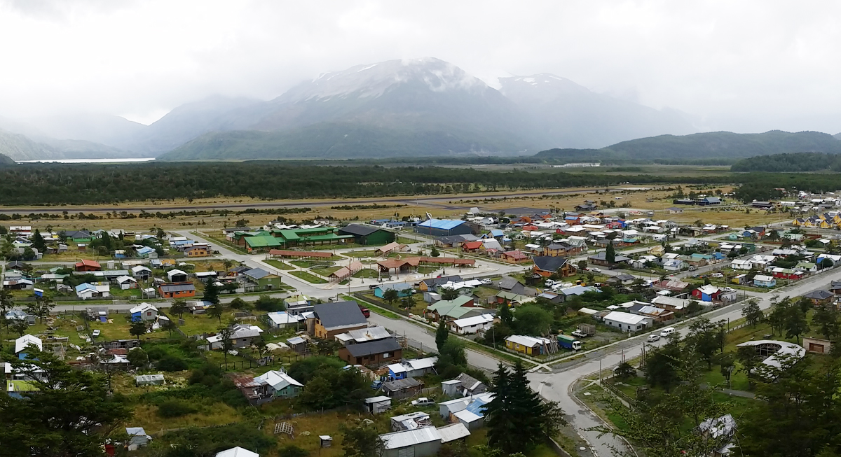
Image via Wikimedia Commons/Abbagliati
Aysén is Chile’s least populated region, with fewer than one person per square kilometer. The scale of open land is immediate, and the distance between towns reinforces it.
Road construction linking the region began in 1980, and Villa O’Higgins at the southern end wasn’t connected until 2000. Even now, the Carretera Austral, that road, runs for hundreds of miles through remote terrain and stops where geography makes further development impractical.
That timeline explains why Aysén feels different from better-known parts of Patagonia. It wasn’t built around tourism early, and many sections still rely on limited infrastructure.
Getting There Is Part of the Experience
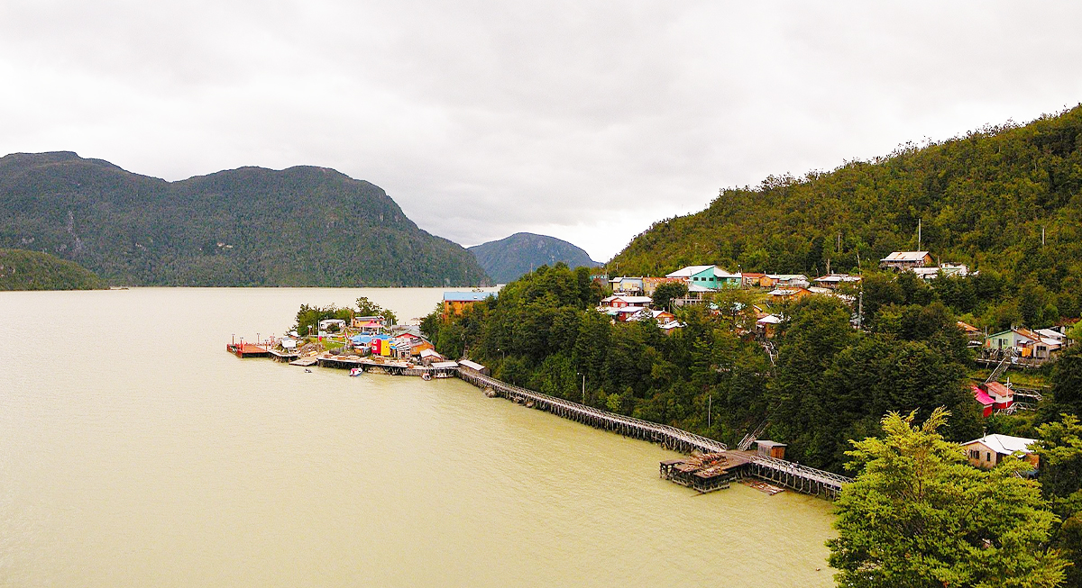
Image via Wikimedia Commons/Jose Salas
Getting to Aysén takes time, and that’s part of what makes it different. From Balmaceda Airport, expect around a five-hour drive to reach places like Lago General Carrera. Head farther south and the roads turn to gravel, services become limited, and travel slows down.
Some places are even less direct. Caleta Tortel has no streets, only wooden walkways, and getting there means navigating coastal terrain. The Marble Caves on General Carrera Lake are only accessible by boat or kayak.
The journey naturally filters who comes here. It’s not built for quick trips. You move more slowly, plan more, and experience the landscape in a way that feels earned.
A Different Experience From Mainstream Patagonia
In Torres del Paine, trails are marked, accommodations are built into routes, and visitor numbers can reach hundreds per day during peak season. Planning often involves booking months in advance.
Aysén operates on a different scale. Trails exist, but many remain lightly trafficked. In some areas, seeing only a handful of vehicles in a day still counts as busy.
Movement becomes less structured, and encounters with other travelers become less frequent. The environment sets the pace rather than a fixed itinerary.
The Landscape Matches Patagonia’s Scale
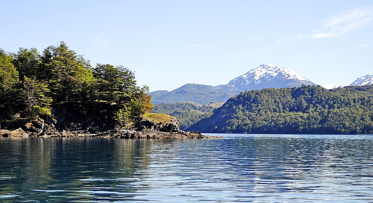
Image via Wikimedia Commons/LBM1948
Aysén covers a vast stretch of northern Patagonia, with access to major natural features that define the region. Lago General Carrera, the second-largest lake in South America, sits at its center, surrounded by glaciers, alpine forests, and the Andes.The Baker River cuts through the region for over 100 miles before reaching the Pacific, while seven national parks and the Northern Patagonian Ice Field extend across the landscape.
These aren’t secondary sights. The same glaciers, lakes, and mountain systems that draw travelers south are present here, spread across a region that sees far fewer visitors.
Travel Here Is Defined by Effort and Distance
Activities in Aysén reflect the terrain. Multi-day treks through areas like Cerro Castillo involve basic campsites and self-sufficiency rather than built lodges. Rafting on rivers like the Baker or Futaleufú requires navigating strong currents and remote entry points.
The Carretera Austral itself becomes part of the experience. It runs for roughly 1,240 kilometers, connecting isolated communities and acting as the main route through the region. Travel along it is slow by design, with changing terrain and limited services shaping each leg of the journey.
This structure attracts travelers willing to commit time and effort. The reward is access to places where movement isn’t guided by crowds or tight schedules.