Top 10 Geologic Sites in the United States
The United States has a habit of showcasing its geology. Long before cities and highways showed up, forces beneath the surface were already shaping cliffs, caves, faults, and craters that still define the country today. These geologic sites remain some of the most compelling places to understand how Earth actually works.
Grand Canyon (Arizona)
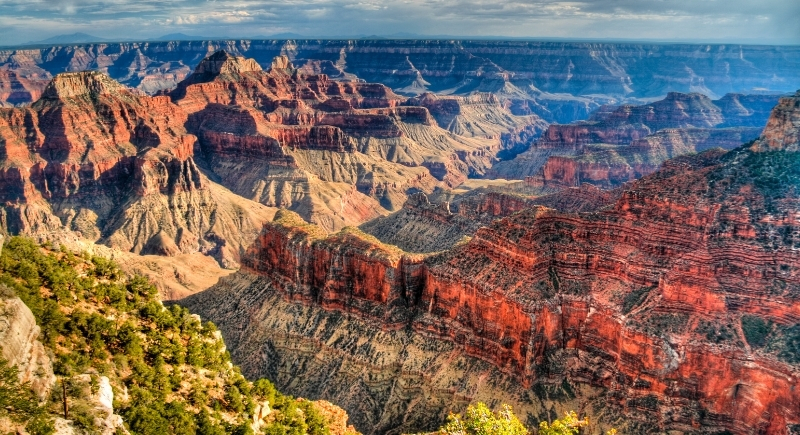
Credit: Getty Images
The Grand Canyon exposes nearly 2 billion years of Earth’s history in visible layers of rock. The Colorado River carved the canyon over a period of roughly 5 to 6 million years, cutting deeper as the Colorado Plateau slowly rose upward. At its deepest point, the canyon drops more than 6,000 feet, which gives geologists a rare vertical timeline of ancient oceans, deserts, and volcanic activity. Native American communities have lived in and around the canyon for thousands of years, treating it as a sacred place long before it became a national park.
Yellowstone National Park (Wyoming, Montana, Idaho)
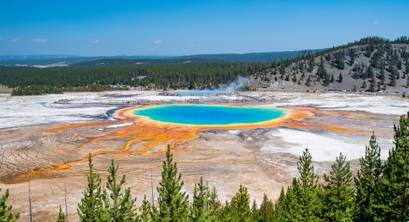
Credit: pexels
Most of Yellowstone National Park is situated atop a dormant supervolcano that continues to fuel geysers and hot springs. The park encompasses approximately half of the planet’s geothermal features, which are powered by magma located miles below the surface. The last major eruption occurred around 640,000 years ago, which may seem distant but is still considered active in geological time. Yellowstone also became the world’s first national park in 1872.
Mammoth Cave National Park (Kentucky)
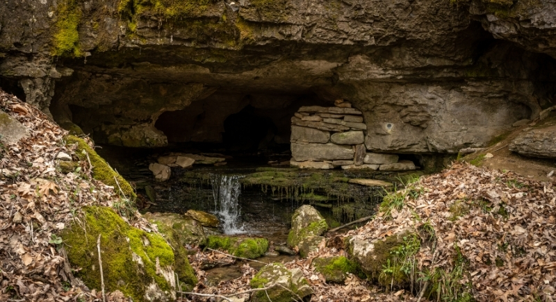
Credit: Canva
In central Kentucky, Mammoth Cave National Park holds more than 400 miles of mapped passageways. The caves formed as groundwater slowly dissolved limestone over millions of years. Native Americans explored these caves over 5,000 years ago and left behind artifacts that still survive in the stable underground climate. During the War of 1812, parts of the cave were mined for saltpeter, a key ingredient in the production of gunpowder.
Lava Beds National Monument (California)
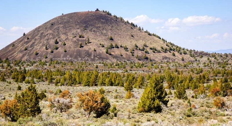
Credit: Getty Images
Located in northeastern California, Lava Beds National Monument is located on the flank of Medicine Lake Volcano, the largest volcano by volume in the Cascade Range. The monument spans over 46,000 acres and features dozens of lava tubes formed when molten rock drained away beneath hardened crusts. Visitors can enter 25 caves with marked entrances, some with smooth floors and others requiring hands-and-knees movement. The area also played a role in the Modoc War of 1872 to 1873, with Captain Jack’s Stronghold still visible today.
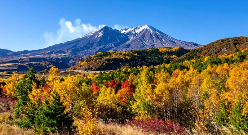
Mount St. Helens National Volcanic Monument (Washington)
Credit: Canva
The 1980 eruption of Mount St. Helens National Volcanic Monument reshaped more than 200 square miles in a matter of minutes. Created in 1982, the monument preserves 110,000 acres where recovery has been allowed to happen naturally. The lateral blast confirmed geologist David Johnston’s warnings, which are now part of volcanic science textbooks. Visitors can drive to Windy Ridge, just 4 miles from the crater, and climbers have been allowed to reach the summit since 1986.
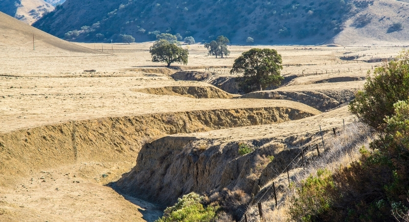
San Andreas Fault at Carrizo Plain (California)
Credit: Getty Images
One of the clearest views of plate movement on Earth appears at the Carrizo Plain, where the San Andreas Fault cuts straight across open grassland. This section of the fault shows visible offsets where the Pacific Plate and North American Plate slide past each other. The plain is about 2,200 feet above sea level and receives roughly 9 inches of rain per year. Soda Lake collects runoff in the center of this enclosed basin.
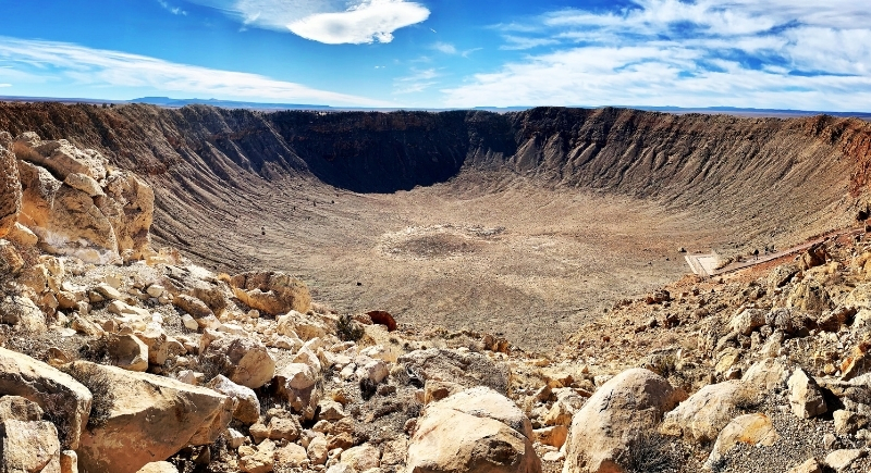
Meteor Crater (Arizona)
Credit: Getty Images
About 50,000 years ago, a nickel-iron meteorite slammed into northern Arizona and created what is now known as Meteor Crater. The impact left a hole nearly 4,000 feet wide and about 560 feet deep, surrounded by a raised rim of shattered rock. Scientists call it Barringer Crater, named after the geologist who proved it came from space. It remains one of the best-preserved impact craters on Earth, situated at an elevation of 5,640 feet above sea level.
La Brea Tar Pits (California)
Credit: Getty Images
Right in the middle of Los Angeles, the La Brea Tar Pits have been trapping animals for at least 40,000 years. Asphalt seeps up through fractures tied to the Salt Lake Oil Field, forming sticky pools that preserve bones with remarkable detail. Radiometric dating indicates that some fossils are approximately 38,000 years old. The site continues to produce discoveries today, which are displayed at the nearby George C. Page Museum.
Niagara Falls (New York)
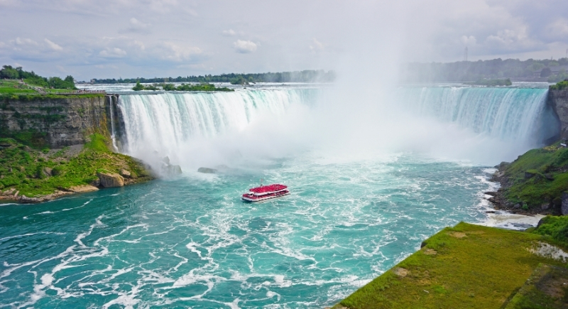
Credit: Getty Images
The constant roar of Niagara Falls comes from water that began flowing after glaciers retreated at the end of the last Ice Age. The falls have been slowly eroding upstream ever since, carving the Niagara Gorge in the process. Scientists have tracked measurable retreat rates over time. The same water later powered some of the earliest large-scale hydroelectric systems in the United States.
Ice Age Floods National Geologic Trail (Washington, Oregon, Idaho, Montana)
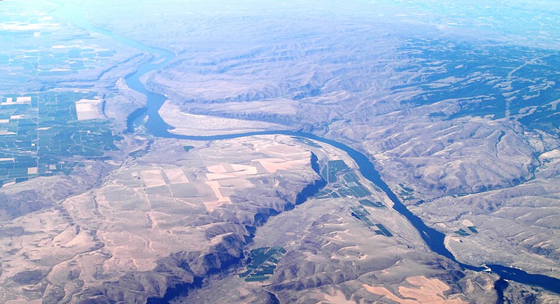
Credit: Wikimedia Commons
The Ice Age Floods National Geologic Trail explains one of the most extreme flood events ever recorded in science. Repeated collapses of Glacial Lake Missoula sent walls of water racing across the Pacific Northwest starting around 110,000 years ago. These floods carved dry waterfalls, massive channels, and scablands that still confuse first-time visitors. The trail, established in 2009, connects key sites rather than following a single path.